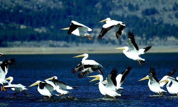
CATHLEEN ALLISON/NEVADA APPEAL A flock of pelicans play in the Washoe Lake Wetland area on Wednesday afternoon. This week's warm weather is expected to give way to a storm front that moves in today.
Temperatures are expected to drop today with a chance of snowflakes in Carson City tonight and highs in the 20s.
"We'll probably get some snow Friday night," said Brian Brong, a meteorologist with the National Weather Service In Reno. "It'll be kind of a light, fluffy snow. We'll get maybe an inch on the valley floor."
Saturday is when it's supposed to get really cold.
"That's when the cold air will be coming down from Canada," said Brong.
High temperatures Saturday are expected to be in the mid to upper 30s.
"Everything bottoms out on Saturday night, Sunday morning," Brong said. "We'll see lows around 10 to 15 in the Carson City area. That'll be probably the coldest air this fall."
This cold weather system is coming down from the north, he explained.
"There's a lot of cold air right now sitting up in Canada, and a low pressure system moving south will pull the cold air down with it."
Things are supposed to warm up a bit by Sunday, however.
"We'll probably get up into the lower 40s on Monday and see it slowly warming into next few weeks."
After today, the best chance for more precipitation is the Thanksgiving Weekend.
Forecasters don't expect much trouble from the wind.
"We had a pretty windy day Wednesday but we don't think it'll be that strong for while," Brong said.
For more information go online to http://www.wrh.noaa.gov/Reno/

Comments
Use the comment form below to begin a discussion about this content.
Sign in to comment