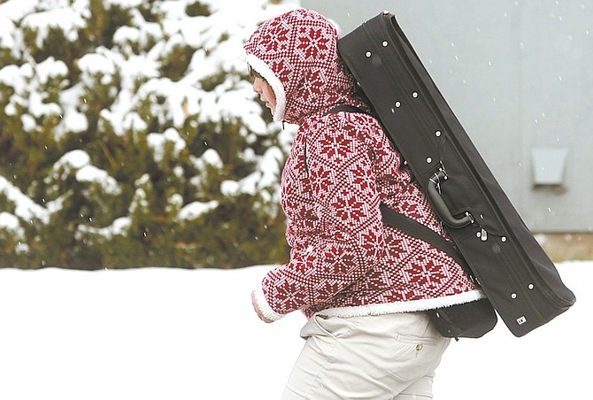
Photos by Shannon Litz / Nevada AppealA student walks in the snow on Friday afternoon. A lake effect band of snow hit the valley Friday bringing hazardous traveling conditions.
A series of accidents on south Interstate 580 at the East Lake Boulevard exit clogged traffic although only minor injuries were reported on Friday.The accidents clustered around noon, right as the heaviest snow was falling. One 5-car accident saw a single patient transported to the hospital with minor injuries, a 4-car and accident and a 2-car one had no injuries and a snowplow sliced off the side-view mirror of one vehicle, according to the Nevada Highway Patrol. Multiple single-car slide-offs were reported in Mound House. The accidents all happened in a snowstorm caused by lake-effect snow, blown off of Lake Tahoe by mild winds, according to the National Weather Service in Reno.Warm Lake Tahoe waters and a mass of very cold air from Alaska and just-right winds propelled snow bands Carson City and Washoe Valley.According to NWS, a lake effect snow warning was in effect Friday and continues until 10 a.m. today. Snow bands coming off of Lake Tahoe hit Carson City and Washoe Valley and are expected to leave between 6 inches to a foot in affected areas. Cold temperatures allowed snow to fall on the valley floors, said Meteorologist Katherine Hohmann with the National Weather Service.“It’s unusually cold,” Hohmann said, adding the extra cold and mid-lake temperatures of 54 degrees, incredible amounts of air instability led to snow bands and lake-effect snow.“With cold air on top and the right wind, heavy snow bands form,” Hohmann said.The snow bands, which can be very localized, can dump up to a foot of snow in their areas after pulling energy and small amounts of moisture off of Lake Tahoe.The warm lake water helped churn up the cold Alaskan air and, coupled with 10-15 mph western winds, allowed the snow bands to form and flow down into the valleys.The lows will stay down in the teens and mid-20s for next few nights. A new storm system may come in on Nov. 15, Hohmann said.With snow melting during the day and very cold nights, ice slicks are a very really possibility, with dry roadways in one portion of the road and ice slicks in the other.Ice and snow bring their own driving hazards, although the new bypass between Carson and Reno has “automatic bridge anti-icers,” which spray an anti-icing solution over the bridges to “help delay and prevent ice,” according to a press release from the Nevada Department of Transportation.SAFE WINTER DRIVINGDespite the anti-ice spray, other methods to prevent accidents rely on sane driving.• Turn off cruise control.• Avoid quick starts, stops and fast turns and accelerate, brake and steer smoothly and gradually.• Drive slower: speed limits are based on normal, not storm, road conditions.• Apply smooth, gentle, steady pressure on brakes. ABS-equipped vehicles pump the breaks if necessary.• Keep additional travel distance between vehicles.• Use extra caution on bridges, ramps, overpasses and shaded areas. Wind blowing beneath objects can cool down roadways faster, creating ice.• If the vehicle begins to skid, steer in the direction of the slide and slowly remove foot from the accelerator.

Comments
Use the comment form below to begin a discussion about this content.
Sign in to comment