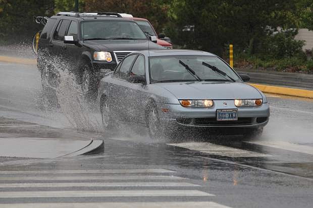
Motorists splash through a puddle at the intersection of Fairview Drive and Roop Street on Monday. More rain is in the forecast for today.
A steady rain fell Monday during a rare August storm in Carson City, leaving temperatures in the mid 70s.
According to the National Weather Service, more rain could be possible in the coming days with forecasted temperatures continuing to rise.
A 30 percent chance of showers and thunderstorms is predicted today with a high near 79. Wednesday’s forecast shows a slight chance of showers, with thunderstorms also possible.
By the weekend, temperatures are forecasted to reach the low 90s.
Although no problems were reported in Carson City because of the rain, officials canceled the annual National Night Out in Mills Park tonight due to saturation at the park, and most of Nevada was under a flash flood watch.
The weather service issued a flash flood warning effective until 3:45 p.m. in central Clark County near Red Rock Canyon. A flash flood watch continued until 9 p.m. Monday in parts of Clark, western Lincoln and southern Nye counties, and in Northern Nevada until 9 p.m. Tuesday for parts of Elko, Lander, Eureka and Humboldt counties.
Temperatures were between 10 and 15 degrees cooler than usual across the state, the weather service said.
On Sunday, Death Valley’s high of 89 was the coolest ever for Aug. 3, shattering the old record of 104 set in 1945. It was only the seventh time since 1911 that the temperature there had failed to crack 90.
It was in stark contrast to the unusually warm July in Nevada. Winnemucca — about 160 miles east of Reno — recorded its warmest monthly average temperature on record in July with 77.5 degrees, the weather service said on Monday.
— Nevada Appeal reporter Teri Vance contributed to this report.

Comments
Use the comment form below to begin a discussion about this content.
Sign in to comment