MT. ROSE SUMMIT — The series of freak snowstorms that occurred in January is described as unforgettable, as it was the most historic weather month in 36 years.
It guided Northern Nevada out of drought conditions, and Lake Tahoe may have a chance for full capacity, said an hydrologist of USDA Natural Resources Conservation Service at Mount Rose on Wednesday.
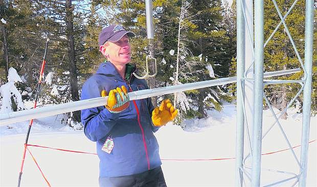
“January 2017 is something we’ll be talking about for years to come,” said Jeff Anderson. “We received three to four times of the amount of snowfall this month as we would typically get in a normal year.”
That’s basically a whole winter’s worth of snowfall. Think of it as three Januarys back-to-back-to-back.
Through depths of snow, hydrologists of NRCS Nevada measured the snowpack core at SNOwpack TELemetry (SNOTEL) site, the summit of Mount Rose. The system debuted in 1981.
The automated SNOTEL sensor reported 150 inches of snow depth and 49.4 inches of water content. In other terms, that’s more than four feet of water in the snowpack. That’s twice as much snow than what the area would typically have in a normal year, Anderson said, and that’s not including a dry year.
The normal peak amount for April 1 is at 134 percent.
Obviously, this is great news for Lake Tahoe. Thanks to the storms, the lake stored 2.6 feet of water, said Chad Blanchard of the Truckee-Carson Federal Water Master’s Office.
“This is more than the typical, annual rise for the year,” Blanchard said.
“We can include the water sitting in the snow and what we’ll receive from upcoming storms.”
Blanchard said it will help lessen the drought impact of the summer.
“The key is we’re storing the snowpack and saturating the soil,” he said. “The run off will be more efficient in the spring when the snow melts. We want it to continue, it’s a full rebound of the drought.”
Although Northern Nevada departed the drought status, Anderson said the area is expected to keep improving, especially at reservoirs and basins throughout the state.
For Carson River Basin, snowpack is 188 percent of normal.
As for snowpack at Lake Tahoe Basin, it tripled. It went from 62 percent to 191 percent in a month’s period, which is sixth best since the mid-1950s.
It’s possible this could make up for the loss during the drought. The Sierra missed about a year and a half of precipitation, about 74 inches missed at Mount Rose. The average is 55 inches.
But based on the precipitation the area already has, Anderson said we have a full year’s worth of water.
“This doesn’t mean we’re at record forever,” Anderson said. “We’re just over halfway to the biggest year ever for the end of the season and well above a normal year. But we don’t need all 74 inches to make it up to reservoirs. The trees didn’t have enough water, either.”
Six percent of the state is still classified as moderate drought, while 23 percent remains abnormally dry. However, the upper Humbolt River is above normal for its snow water equivalent.
With more forecasts of winter storms making its way, Blanchard said to embrace it instead of dreading it.
“There’s always a threat when we have a large rainstorm and high snow levels,” he said. “It’s a risk with the extremely wet soil conditions and low elevation. Although it increases the threat, it’s great for the water supply.”
February may be close to an average month or below average — but that’s OK, Anderson said.
“Whatever snow or rain the area receives, it’s gravy adding to the snow that’s already here,” he said.
“It’s a tremendous comeback.”

Comments
Use the comment form below to begin a discussion about this content.
Sign in to comment