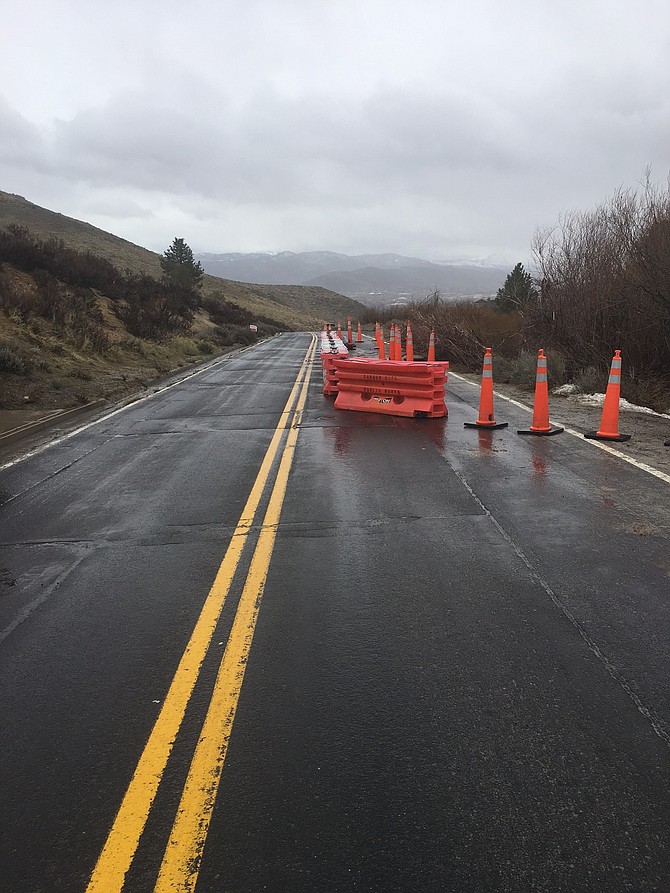
Update, Tuesday 3:48 p.m.:
Due to flooding that occurred this morning, a 100 foot section of Combs Canyon Road that is 1/8 of a mile south of the Lakeview Road intersection will be closed to one lane of travel.
The adverse weather, saturated soil, and exposed underground utilities make the permanent repair difficult. The west side of the road is expected to be closed for approximately four weeks and is unsafe for travel.
Public Works staff is asking the public to avoid driving on Coombs Canyon Road, if possible. Local traffic is advised to use the Highway 395 egress/ingress for the Lakeview subdivision when possible and remember that when using Combs Canyon Road drivers should use care and caution when approaching on-coming traffic.
_________________________________________________
Update, Tuesday 12:40 p.m.:
Lyon County is experiencing localized flooding throughout Central Lyon County. The following roads are closed by Lyon County:
- River Road at Cardelli Road
- Fort Churchill Road from Riverview Elementary School to the Nevada Automotive Test Center
- Break-A-Heart from Highway 50 to Fort Churchill Road
- Opal Avenue, Topaz Avenue and the Tahoe Avenue are currently impassible. These roads are in Silver Springs.
Crews cannot do any repair work until the water stops flowing.
All drainages are flowing water and staying in the banks at this time. Lyon County officials urge the public to keep all flood mitigation efforts in place. Sandbag locations have been left open since the January event. Lyon County crews continue to monitor roads and drainages and will continue to report any problems. There have been no reported fatalities or injuries and no evacuations are in place. Lyon County officials have been briefed by the National Weather Service and understand that flooding may continue throughout the week.
_________________________________________________
Update, Tuesday 11:26 a.m.:
From the Carson City Public Works, crews are mitigating flood prone areas and will address concerns accordingly. The storm drain system is operating at capacity, resulting in water in roadways and localized intersection flooding. When the storm drains are at maximum capacity water can be observed flowing outwardly. This is a normal response. All personnel are at their full ability assisting citizens.
Carson City Public Works encourages residents to visit www.carson.org to stay up-to-date on the weather, road closures, trail/path closures, sandbag locations and resources that are deployed across the city. All official public information that is released will be posted to the flood site.
A Flood Hotline has been designated for flood related reporting and questions, which are not life-threatening. The number is (775) 887-2355 and officials ask the public to use this number instead of 9-1-1 for non-emergency flood calls.
Please be watchful of City crews working as they continue to mitigate and assess storm damage. The following roads are closed:
• Rhodes Street is closed from Carson Street to Curry Street
The following parks and trails are closed:
• Linear Ditch Trail from Airport Road to Saliman Road
• Mexican Ditch Trail south of Silver Saddle Ranch
• Moffit open space trail between Lepire Drive and Hells Bells Road
• Long Ranch open space trails near the creek
• Morgan Mill access and road
• Blackwell Park
• Mayor’s Park
• Mills Park (Roop Street entrance only may be used. The Aquatics Facility and the Community Center are open.)
Please use extreme caution throughout the City’s trail systems. Saturated soils have washed out many trails and contributed to erosion. Safety concerns regarding parks, trails and open space should be called into: (775) 887-2262.
We encourage drivers to exercise caution as road conditions can become dangerous.
_________________________________________________
The National Weather Service (NWS) in Reno has issued a flood warning for Carson City and much of western Nevada, including Douglas, northern Lyon and Storey counties.
The warning is in effect until 3:30 p.m.
Two inches of rain had fallen across the Carson Range and and up to half an inch along the I-395 corridor by 6:34 a.m.
“The greatest threat for flooding is near creeks, streams, ditches, urban areas, construction sites, farmland and pastures. Motorists commuting this morning should slow down and be prepared for ponding of water on roads,” the warning said.
A moderate to strong atmospheric river is expected to bring heavy rain with high snow levels today.
The NWS also issued a high wind warning through 10 p.m.
In the valleys, winds are expected to be 20 to 40 miles per hour with gusts of 50 to 65 mph.
In Washoe Valley, gusts could exceed 70 mph, NWS said.
To view current flooding incidents in Carson City, visit: http://carsoncity.maps.arcgis.com/apps/webappviewer/index.html?id=56d7e396d24845519638c1a0ca08309c

Comments
Use the comment form below to begin a discussion about this content.
Sign in to comment