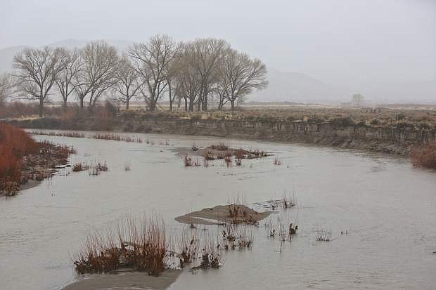
The Carson River is seen at the Cradlebaugh Bridge as it flows under Hwy. 395 in Minden Wednesday.
A weekend storm is expected to produce flooding in Carson City and throughout the region similar to the flood of 2005.
The National Weather Service (NWS) is predicting the Carson River in Carson City will peak at 11.5 feet Monday afternoon, causing major flooding, especially in the Carson Valley. In 2005, the river topped out at 11.45 feet.
A mix of freezing rain and snow is expected to hit Saturday morning, with a warming trend in the evening and torrential rains starting and lasting into early Monday.
“Widespread flooding including rivers certain. One of the most favorable flood scenarios we’ve seen in years. Think 2005 for planning,” said an NWS Reno alert.
The highest flood risk is Sunday and Monday, and on creeks, burn areas, urban poor drainage, construction areas, and rivers.
In Carson City, that includes drainage areas such as Ash, Combs and King’s canyons, and property near the Carson River, said Daniel Rotter, Carson City engineer.
Flooding may cause widespread power outages.
“Make sure your mobile phones are charged, you have plenty of bottled water and are prepared with food to get you through because it could be a couple of days before the power would be restored,” said Emergency Manager and Carson Fire Chief Bob Schreihans.
Emergency Management is advising residents to be prepared with a 72-hour kit with extra water, a three-day supply of non-perishable foods, a flashlight and batteries, and a first aid kit.
A non-emergency flood hotline is at 887-2355 for all calls and questions that are non-life threatening emergencies.
Also, a map of the city with live information on the flood is online at carson.org/government/departments-g-z/information-technology/flood-alert-page.
Residents can sign up for CodeRED emergency alerts to their cell phones and email at carson.org/alerts.
Do-it-yourself sandbag filling stations are available at 202 S. Curry St., near 3rd Street; Fire Station No. 52, 2400 E. College Pkwy.; Ross Gold Park, 280 E. Appion Way; Ormsby Boulevard at Washington Street; Winnie Lane at Foothill Drive; and at the Carson City Corporate Yard, 3505 Butti Way.
If needed, an evacuation shelter will be designated from several identified shelters in the city, including the Multi-Purpose Athletic Center, Carson High School, the Carson City Community Center, Carson Middle School, Eagle Valley Middle School, Al Seeliger Elementary School and Carson City Fairgrounds/Fuji Park.
The city posted a video with information at www.youtube.com/watch?v=rR7b1KpYfpU.
More safety information is available at www.nevadafloods.org.
Another storm is expected Tuesday into Wednesday with snow in the mountains and rain in the valleys with lots of wind, and possibly more flooding.
A storm forecast for Friday is less likely to produce more flooding, said NWS Reno.

Comments
Use the comment form below to begin a discussion about this content.
Sign in to comment