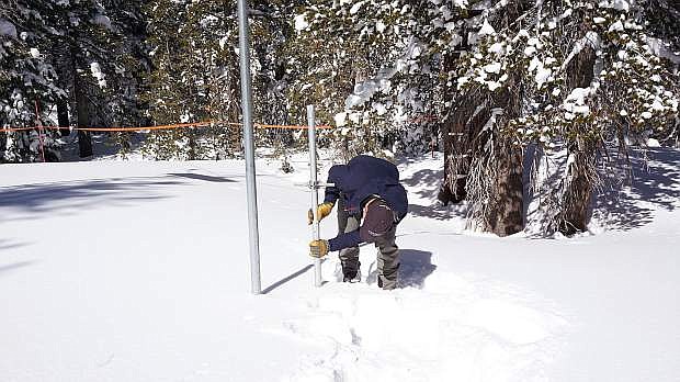
Jeff Anderson, hydrologist for the Natural Resources Conservation Services, measures the snowpack on Mt. Rose on Monday.
MT. ROSE — March 2018 will go down as the fourth largest March snow total since 1980,
The snowfall amount was confirmed Monday from measuring the snowpack with Jeff Anderson, hydrologist for the Natural Resources Conservation Services.
Monday’s snowpack data was 101 measured inches of snow depth and 34.2 inches of water content, which is 93 percent of the median amount. For the Carson Basin, snowpack on March 1 was at 36 percent of median spring peak amount, and increased by 46 percent to 82 percent median spring peak by April 1.
“So if you melt down all these inches of snow, you’d be standing in almost 3 feet of water,” Anderson said on a sunny spring day. “We definitely had a miracle March. Just last month, on March 1, the snowpack here at Mt. Rose was only 48 percent of the median peak, so it almost doubled in one month.”
The term “Miracle March” comes from when there’s a dry winter with little snow up until March 1, and then March comes in and the snowfall totals increase. The classic example for this is 1991. Snowpacks in the Sierra were just 15 percent of the normal peak on March 1, 1991, and increased by 70 percent by April 1. This year had similar numbers to 1991. Snowpacks in the basins were 32 percent of the median peak on March 1 and increased to 77 percent by April 1.
The biggest recorded Miracle March was in 1995 with a snow water increase of 27.5 inches. That year there was a 60-70 percent increase.
Even with the increases in March, snowpacks across the Tahoe region and across the rest of Nevada still are slightly below average. But Anderson doesn’t seem to worried.
“This means we are going to see a lot more water coming down our rivers and into the lakes and what not, and that’s really great news. And not only did the Sierra see a pretty great bump in the snowpack, but also the rest of Nevada did too … it’s good news for all of Nevada,” said Anderson. “The saving grace of this year is the snow from last year, which kept our reservoirs really high. And now we’re in a situation where the reservoirs are going to be great again for this summer.”
Reservoir storage is excellent in Northern Nevada, causing less reason to worry for water supply, but for people who depend on natural streamflow, expect streamflow to be less than normal.
“March 1 we were looking at potentially not filling our reservoirs,” said David E Wathern, chief deputy water master for the United States District Court. “Coming into this year, we had such high carry over, it wasn’t going to take much to fill them, but we were at a point, with such dismal runoff expected March 1, now it’s looking like we will fill easily and spill. We’re spilling water out of Lake Tahoe.”
NRCS installs, operates and maintains an extensive, automated network of SNOTEL weather stations to collect snowpack and related climatic data in the Western United States. In addition to measuring the snowpack’s water content SNOTEL sites also measure annual precipitation, air temperature, snow depth and soil moisture.

Comments
Use the comment form below to begin a discussion about this content.
Sign in to comment