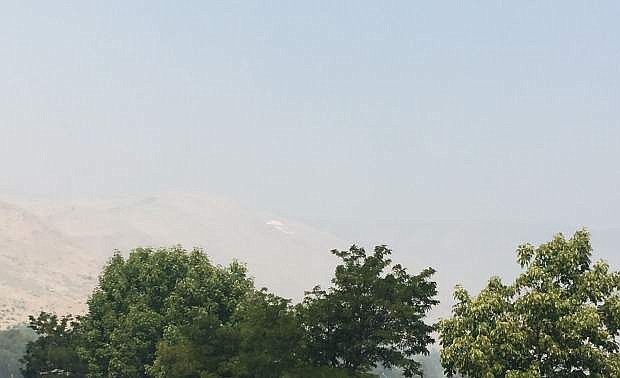
The 'C' and American flag on C Hill are barely visible through the haze on Monday.
The smoke inundating Eagle and Carson valleys on Monday isn’t going away anytime soon.
The National Weather Service forecasts “widespread haze” in Carson City until at least Thursday night.
High temperatures also are expected to rise into the middle 90s in the middle of week before dropping slightly to the low 90s by the weekend.
Monday morning, the air quality index for Minden and Gardnerville was in the hazardous range (read story by clicking here). Carson City was slightly better, with “unhealthy” air.
The week’s forecast from the NWS:
Monday: Widespread haze. Areas of smoke. Sunny, with a high near 91. Calm wind becoming northeast around 5 mph.
Monday night: Widespread haze. Areas of smoke before 11 p.m. Clear, with a low around 54. Northeast wind around 5 mph becoming southwest after midnight.
Tuesday: Widespread haze. Sunny, with a high near 96. Calm wind becoming northeast around 5 mph in the afternoon.
Tuesday night: Widespread haze. Clear, with a low around 57. North wind around 5 mph becoming calm in the evening.
Wednesday: Widespread haze. Sunny, with a high near 99. West wind around 5 mph becoming calm.
Wednesday night: Widespread haze. Clear, with a low around 58.
Thursday: Widespread haze. Sunny, with a high near 95.
Thursday night: Mostly clear, with a low around 59.
Friday: Mostly sunny, with a high near 93.
Friday night: Partly cloudy, with a low around 59.
Saturday: Sunny, with a high near 91.
Saturday night: Mostly clear, with a low around 59.
Sunday: Sunny, with a high near 92.

Comments
Use the comment form below to begin a discussion about this content.
Sign in to comment