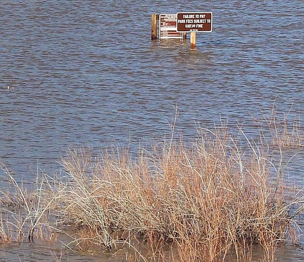
The Carson River flooded south of Silver Springs and inundated campgrounds this past winter/spring.
FALLON, Nev. — The boards of the Truckee Carson Irrigation District and Churchill County Commission recently received an update on the 2017 water year from the general manager of the Carson Water Subconservancy District — and with that, a glimpse of what the future holds for water and growth along the Carson River corridor from Dayton to Silver Springs.
Ed James said, without a doubt, the 2017 water year in Northern Nevada broke “all kids of records” that were set more than 30 years ago.
Even with a record year, however, James said growth from Dayton to Silver Springs may be based on water availability. He said the state engineer met with area residents recently regarding their water availability. James said what’s predicted on paper may not be what’s in the ground.
“People need to be cautious, aware and how much water is physically available,” James said, adding there’s a big use for domestic wells in the Silver Springs area.
Because of the USA Parkway extension, which opened in late August 2017 and extends from Interstate 80 to U.S. Highway 50 near the Silver Springs Airport, James said more growth from housing and businesses will put a strain on water resources.
He said it’s a question for Lyon County and Silver Springs on how to handle water and growth. He said the developer of one industrial project that straddles USA Parkway, for example, recently bought rights to 24,000 acre-feet of surface water.
“A lot of developers want to come out to Silver Springs, but they may have to bring water from other sources,” James added.
James said the CWSD and local governments are facing general water issues if a worst-case scenario of population growth occurs.
He said the high-end of growth by 2050 could see upward to 400,000 people living within the boundary of the Carson River Watershed, which begins in Alpine County, Calif., and extends eastward past the Carson Sink.
Future issues will focus on infrastructure needs, water use, potential water law changes, limited water supply east of Dayton, need for more induction wells, water quality concerns and need for upstream storage.
What people don’t realize, said James, is the Alpine Compact stipulates 95 percent of the Carson River water is allocated for agriculture.
James, however, said the 2016-17 was an exceptional water year. The total water year precipitation for the northern Sierra mountain range began to show upward trends in December 2016, and continued to stay ahead of the 1982-83 water year by averaging 94.7 inches of precipitation. He said records were set at 8,000 feet and higher.
During the 1982-83 water year, the average came in at 88.5 inches, followed by the wet winter of 1997-98 at 82.4 inches. To contrast the highest average, the second lowest record in modern recorded history came in 1976-77, with an average of 19 inches.
According to a snow-water content trend line from 1950-2015 for 13 northern Sierra snow courses, James said the area has been experiencing lesser snowfall totals; however, he said more water in the form of the runoff is occurring in the spring.
James said because Northern Nevada had been in a drought so long, 2016-17 wasn’t as huge as 1997, but it had a bigger impact.
“The river functioned like it’s supposed to,” James said. “We had some flooding in Lyon County and had a lot of runoff.”
Local runoff was measured at Carson City, Fort Churchill and below the Lahontan Dam. During the 1983 water year, the water flow at the Carson City gauge registered at 826,225 acre-feet of water, compared to 2017’s 928,120 acre-feet.
The total at Fort Churchill was 926,885 acre-feet of water in 2017, compared to 84,105 acre-feet 34 years earlier. More water, though, flowed below the dam in 1983 compared to this year — 771,414 acre-feet of water to 692,974.
The difference, James said, centers on Lahontan Reservoir. When flooding occurred in 1983, Lahontan Reservoir was almost full, but the reservoir was almost dry at the beginning of December 2016 when storms began to pound the Sierra.
By tracking forecasts and trends, TCID, the Bureau of Reclamation, the National Weather Service and other agencies began to map out a plan to increase the flow out of Lahontan Reservoir beginning in February so that more water could be stored there and in other smaller reservoirs around Churchill County during mid-to-late spring.
Hydrologists and meteorologists estimated the snowpack in the Sierra would equal the precipitation equivalence of three Lahontan reservoirs or almost 900,000 acre-feet of water.
TCID and Churchill County spearheaded construction of an emergency weir and spillway from the V-Line Canal, the main artery that delivers water in the Lahontan Valley. Thousands of acre feet of water began flowing in late March into the Nevada desert south of the canal and under culverts to Carson Lake and eventually to Stillwater Refuge and the Carson Sink.
“You did an amazing job,” James said. “The work you did to move water in March, April and May was huge.”
Because of the flooding in the 1980s, the Nevada Legislature mandated the Carson Water Subconservancy District would be responsible for the management and development of water resources in the upper Carson River. The new responsibility charges the CWSD alleviate reductions and loss of water supply, promote conservation and project the health, safety and welfare of the people who live in the upper Carson River basin.
CWSD functions with 14 members representing six counties in two states and is funded by property tax and grants. The watershed encompasses an area of 3,966 square miles with the 184-mile long Carson River snaking through a five-county region.

Comments
Use the comment form below to begin a discussion about this content.
Sign in to comment