The California National Historic Trail Interpretative Center is located along Interstate 80, about eight miles west of Elko. I had driven by there several times in the past but had never stopped there.
Recently, Steve Lake contacted me about writing an article about the center to tell what it has to offer.
With the summer months approaching, he thought the California Trail Center would be a good addition to any road trip or summer vacation you may be planning.
In addition, for future planning, the trail center is an excellent source of stories and materials in and around Nevada Day in October.
The California Trail Center was created through Public Law 106-577 in 2000. The bill included $10 million in appropriated federal funds to construct and develop a major western cultural and educational attraction in northeastern Nevada.
The 16,000 square foot center opened in 2012. It chronicles the 19th century overland journey of more than 250,000 settlers to California between 1841 and 1869.
Many pioneers endured this 2,000-mile trek in search of land, gold, adventure, freedom, or a better life. They generally traveled with covered wagons drawn by horses, mules or oxen. The people often walked most of the way if they were able.
The trail began along the Missouri River and continued for 2,000 miles across the plains, and over the Sierra Nevada mountains with a final destination of Northern California.
The California Trail split from the Oregon Trail at Fort Hall, Idaho and went southwest into the Great Basin. The trail center is aimed at reimagining naturally or culturally significant stories of the trail through visitor participation, including interactive exhibits that follow the pioneers with dioramas designed to immerse patrons in the trail experience. Costumed interpretations, demonstrations of every day life on the trail also are included along with a reconstructed Shoshone village and wagon encampment.
The hardships these pioneers endured helped to shape the history of the West, but few people today know much about it, even Native American Indians who were often helpful to the pioneers such as Fremont and others.
The trail center is open Wednesday-Sunday from 9 a.m. to 4:30 p.m.
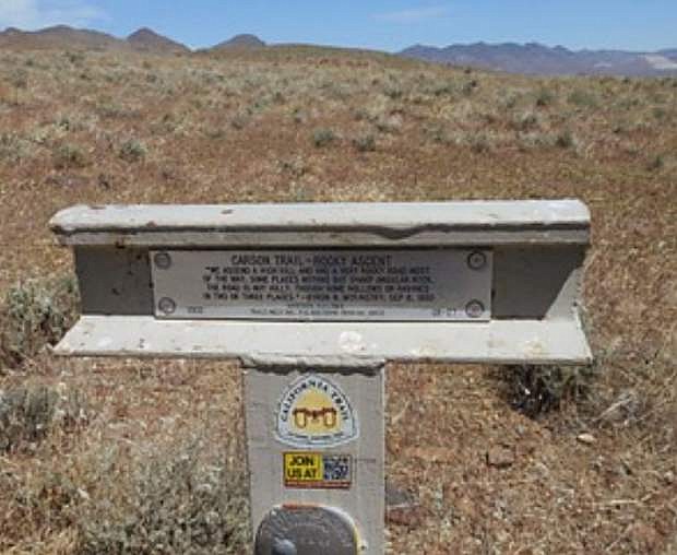
In a more personal note, when I was an inspector on highway construction projects years ago, I made a game out of seeing how many of the California Trail markers I could find along the route of Interstate 80 from Verdi on the west border to just east of Elko.
The trail markers are sturdy steel rails in a “T” shape that can be seen at a distance with a pair of binoculars. I was able to find some of the markers in every county along the route of Interstate 80.
Each of the markers has the official trail marker insignia and a quote, probably from a pioneer diary, about the site of the marker.
It’s important to point out the trail has many different cutoffs, such as the one that splits off at the Humboldt sink and crosses the 40-mile desert in two different directions. One travels south to Ragtown and the Carson River and the other travels southwest to Wadsworth and the Truckee River.
Happy trails to everyone!
This article is by Dayton author and historian Dennis Cassinelli, who can be contacted on his blog at denniscassinelli.com. All Dennis’ books sold through this publication will be at a 50 percent discount plus $3 for each shipment for postage and packaging.

Comments
Use the comment form below to begin a discussion about this content.
Sign in to comment