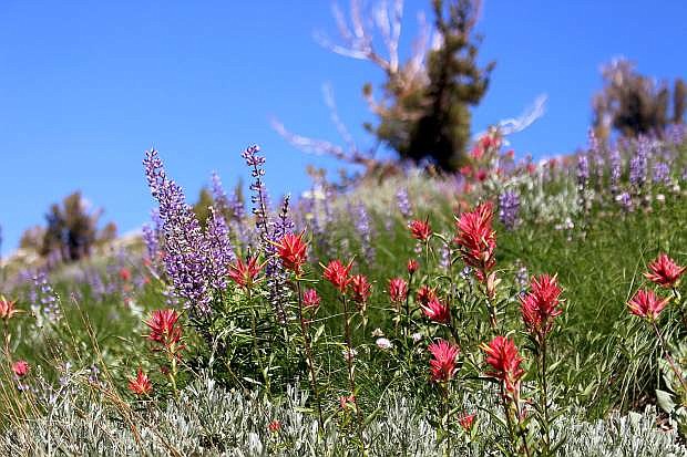
In the summer, wilderness areas around Tahoe burst with wildflowers.
More so than ever, Americans are turning to nature as an antidote to modern life. Thankfully, there are thousands of protected natural spaces around the country to escape to, from state and national parks to wildlife refuges and Bureau of Land Management parcels.
But no area of land is sheltered more from the imprint of man than the United States’ wilderness areas. The Wilderness Act of 1964 was penned by The Wilderness Society’s Howard Zahniser and signed into law by President Lyndon B. Johnson. The act created the National Wilderness Preservation System and initially designated 9.1 million acres of wilderness for protection.
The Wilderness Act prohibits roads, permanent structures or use of any mechanized machines in its lands. Even mountain biking is banned in these areas, and rangers must use hand saws instead of chainsaws for trail clearing.
Today, there are 757 wilderness areas encompassing nearly 110 million acres of federally-owned land in 44 states and Puerto Rico — roughly 5 percent of the land in the United States.
The Wilderness Act, as far as laws go, is rather poetic. It describes wilderness as “an area where the earth and its community of life are untrammeled by man, where man himself is a visitor who does not remain.” The act also mandates “outstanding opportunities for solitude or a primitive and unconfined type of recreation.”
California and Nevada followed suit with their own wilderness protection acts of 1984 and 1989, respectively.
There are a number of wilderness areas surrounding the Lake Tahoe region, including Desolation, Granite Chief, Mt. Rose, Mokelumne and Carson-Iceberg wilderness areas. The best way to understand why these lands are so important to protect is to get out and experience them.
Desolation Wilderness – ‘Poetry to the eyes’
The 63,960 acres comprising Desolation Wilderness was included in the National Wilderness Preservation System in 1969. With over 130 alpine lakes and easy access from dozens of trailheads, Desolation is the most-visited wilderness area in Tahoe.
“It’s poetry to the eyes,” says Desolation Wilderness Program Manager Don Lane, who has worked for the Forest Service for over 40 years. “People will go to these wilderness areas to escape, to experience nature, the trees, the soft sounds of the winds blowing and the birds chirping.
“It’s a whole different natural experience and that was the intent of the Wilderness Act even back then.”
Eagle Lake and its namesake falls, which spill into Emerald Bay, is a popular destination within Desolation Wilderness, as well as the arduous trek up to Mount Tallac at 9,735 feet with sweeping views of Big Blue.
However, the real beauty of Desolation Wilderness is skipping the well-known trails and taking off on a multi-day backpacking trip with frequent stops for swims in its plentiful lakes.
But, take note: Desolation is under incredible pressure due to its easy accessibility. Between 2006 and 2018, the number of visitors to Desolation jumped from 120,000 to 175,000.
“I’m trying to do everything humanly possible to protect and manage Desolation for today’s people and future generations,” says Lane. “But we need people to take care of the land while they’re out there.”
Granite Chief Wilderness – ‘So close, yet so untouched’
Granite Chief Wilderness is a playground for hikers and backcountry skiers and boarders. The 25,680-acre wilderness area in the Tahoe National Forest is tougher to access and therefore does not see nearly the same visitation numbers on its trails as Desolation.
“It’s lush and overgrown, and it’s so close, yet so untouched. You really feel like you’re in the wild, and you’re the only one out there. In our society, that’s hard to find,” says Heather Kenison, an 18-year Squaw Valley resident and Slow Food Lake Tahoe boardmember who’s hiked extensively in Granite Chief. “I love that you can’t ride a bike there or run a chainsaw. As our population grows and our lives become more digitally influenced and mechanized, in order to find peace, we all need these wilderness areas to get back to what’s important in our own human selves.”
The land on Lake Tahoe’s northwest shore was designated a wilderness area in 1984.
Granite Chief features a diverse terrain of glacially-carved valleys, mountain meadows, lush forests and 9,000-foot peaks.
A 4.8-mile hike to Five Lakes, an aptly-named series of alpine lakes, is a popular trail in the wilderness area.
“When you’re standing above Shirley Lake and looking out toward Tinker’s Knob and beyond, if you look along the top of the peaks, that whole area used to be inside a volcano. That’s what dictates a lot of the rocks that you see,” says Kenison. “I love going up there and thinking about all of the material and thinking about how huge the mountain used to be.
“I’m not a very religious person, but when I go out into the wilderness, I feel like I’m going to church.”
Mt. Rose Wilderness – ‘Really Beautiful views’
Mt. Rose Wilderness, nestled between Lake Tahoe and Reno, received its wilderness designation in 1989. The 31,310 acres encompass most of the high country of the Carson Range, including its tallest peak, Mount Rose, at 10,778 feet.
The wilderness area is split in half by a pre-existing jeep road. The northern portion is made up of 5,860 acres containing the Hunter Creek Canyon complex. The 25,450-acre southern portion features Mt. Rose as well as the tallest ridgelines and deepest canyons of the Nevada portion of the Carson Range.
“Mt. Rose wilderness is cool because it’s an urban interface. People are getting out and hiking, trail running, horseback riding,” says Nora Kaufmann, stewardship program manager for Friends of Nevada Wilderness, a nonprofit dedicated to protecting the state’s public lands. “The Hunter Creek Trail right outside of Reno takes you into Mt. Rose Wilderness — I don’t think some people realize that — and a ton of people use the Mt. Rose Summit Trail that starts at the top of (Mt. Rose) highway.
“It’s got really beautiful views of Lake Tahoe and Reno.”
Though this 10-mile out-and-back with nearly 1,800 feet in vertical gain is a popular ascent of the summit, there are multiple — and often more challenging — ways to reach the peak.
“I believe very strongly that there’s a place for everything,” adds Kaufmann. “Wilderness is a place for our wild spots. It’s a place where we can recognize and appreciate the intrinsic value of the outdoors.
“It’s why it’s so important to practice Leave No Trace principles when you’re out there.”
Mokelumne Wilderness – ‘a real adventure’
The rugged 105,165-acre Mokelumne Wilderness straddles the crest of the central Sierra Nevada within the Stanislaus, Eldorado and Toiyabe national forests.
The landscape is dominated by volcanic ridges and peaks, ranging from about 3,900 feet near Salt Springs Reservoir to 10,380 feet at Round Top where snow can linger into June.
In contrast to its rugged peaks, the wilderness area is known for its vast meadows, cut through by small streams, that burst with wildflowers during the summer months.
“The magic of the Mokelumne area is it is so close to Tahoe but has a completely different and secluded feel,” says Chris McNamara, a South Lake Tahoe-based big wall climber, climbing guide book author and founder of OutdoorGearLab. “The Mokelumne River Canyon is one of the deeper canyons in the Sierra and rises 4-5,000 feet from a river loaded with waterfalls and swimming holes.
“It would be more crowded, except for the fact that the trails are often overgrown and there is a lot poison oak and rattlesnakes. It’s a real adventure down there.”
Carson-Iceberg Wilderness – ‘you get a different flavor’
Carson-Iceberg Wilderness spans portions of the Humboldt-Toiyabe and Stanislaus national forests south of Lake Tahoe.
The 161,000-acre wilderness area was established in 1984 and named for the Kit Carson, an early explorer out West, and a distinctive rock formation called the Iceberg on the southern boundary.
Spanning the eastern and western slopes of the Sierra, Carson-Iceberg ranges from 5,000 feet at Donnell Reservoir to 11,400 feet at Sonora Peak. With relatively few lakes, the area is known for its deep river canyons surrounded by lush vegetation.
“I really like hiking north from Sonora Pass on the PCT (Pacific Crest Trail),” says Carson-Iceberg Wilderness Manager Joel Silverman. “You get a different flavor of rock formations, and there are some really good wildflower displays.”
Carson-Iceberg is also home to the headwaters of the East Fork of the Carson River, the Clark Fork of the Stanislaus, and the Mokelumne River.
“We have very little land in the United States that’s been preserved in the state it’s been before we’ve done so much development,” adds Silverman. “It’s such a wonderful, refreshing experience to be in it and to see people appreciate the solitude.”

Comments
Use the comment form below to begin a discussion about this content.
Sign in to comment