Traffic moves west along Interstate 80 west of Reno, Nev., as a heavy, wet storm hits Northern Nevada on Sunday, Dec. 2, 2012. A powerful storm delivered more snow and less rainfall Sunday to the Sierra than forecast, blunting the flooding danger on the Truckee River in California and Nevada, forecasters said. (AP Photo/Cathleen Allison)
RENO (AP) - A powerful storm delivered more snow and less rainfall Sunday to the Sierra than forecast, blunting the flooding danger on the Truckee River in California and Nevada, forecasters said.
Gary Barbato, a hydrologist with the National Weather Service in Reno, said the colder-than-expected storm caused snow levels to drop earlier and lower in elevation than forecast.
That's welcome news for those living and working along the Truckee, which flows more than 100 miles from Tahoe to Nevada's Pyramid Lake near Reno, he said.
"It could lower the flood threat on the Truckee River," he told The Associated Press on late Sunday morning. "I'm not sure by how much yet. Maybe dramatically, but we'll have to see."
Barbato said his agency's flood forecasts would be revised later Sunday afternoon. The weather service originally called for major flooding Sunday around Truckee, Calif., and for minor to moderate flooding Sunday and Monday around Reno.
At Truckee, 30 miles west of Reno, city officials were focusing on snow removal Sunday afternoon instead of flood control after the town received 4 to 5 inches of snow in the morning, said Assistant City Manager Alex Terrazas.
"We continue to keep an eye on the river, but things are certainly better than they could have been," he said. "We'll transition back to flood management if we need to."
As of Sunday morning, the river was flowing at 3.8 feet near the Sierra town and was expected to crest at 5.4 feet at 4 p.m. Flood stage is 4.5 feet. Dozens of homes and businesses are located along the river in the town of 16,000.
At Reno, the river was at 5.7 feet Sunday morning and expected to crest at flood stage at 11 feet at 4 p.m.
In nearby Sparks, the Truckee was at 5.9 feet Sunday morning and expected to crest at 18.7 feet at 9 p.m. Flood stage is 16 feet. Sparks is home to a riverside industrial area whose businesses employ 20,000 to 25,000 people.
Northern Nevada authorities declared a state of emergency Friday after forecasters issued a flood warning for the length of the Truckee. Roads were closed and sandbags were placed outside homes and businesses ahead of the latest storm.
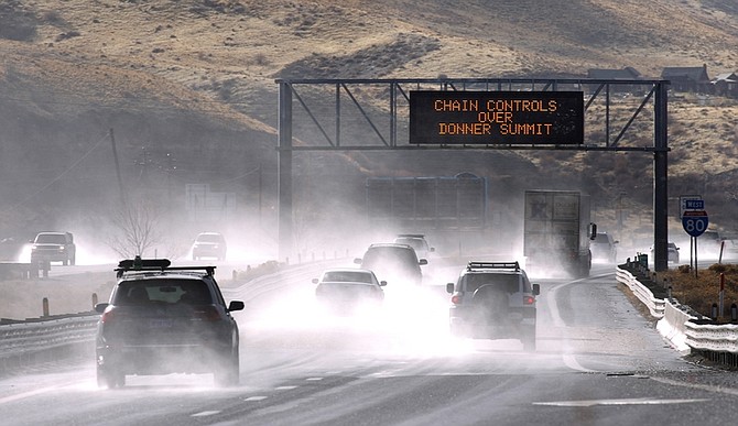
Tire chains were mandatory Sunday afternoon on all vehicles except four-wheel drives on all three major highways linking the Sacramento and Reno areas: Interstate 80 over Donner Summit, U.S. 50 over Echo Summit and State Highway 88 over Carson Pass.
Rockslides were reported Sunday on Highway 89 near Emerald Bay on Tahoe's west shore and along I-80 west of Reno.
The storm also shut down lifts at many Tahoe-area ski resorts Sunday, including Boreal, Kirkwood, Heavenly, Mt. Rose and Squaw Valley.

Comments
Use the comment form below to begin a discussion about this content.
Sign in to comment