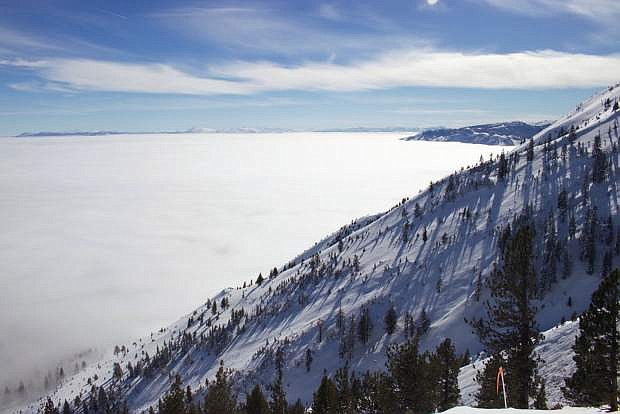
A blanket of clouds covers Carson City. Photo by Kurt Meyer.
Although Carson City witnessed some sun and fairly clear skies after the two-week wrath of a monster storm, it doesn’t mean residents can start unwinding.
Take this morning’s freezing fog as a warning; more snowstorms are planning to make a visit this week by Wednesday and Thursday, according to the National Weather Service in Reno.
However, the storms won’t be as strong as the last.
“There doesn’t need to be further preparation,” said NWS Meteorologist Jim Wallmann. “However, if sandbags and other preparation is already in place from the previous weeks, it’s good to keep everything where it’s at. Soils are saturated; every time we get a strong storm, we’re at risk for the rest of the winter.”
So, don’t clean up just yet; light to moderate rainfalls with wind gusts of 40-50 mph are expected on Wednesday night. Snow is expected to hit the valley floor Thursday, with snow showers throughout the day. The Sierra is expected to get at least a foot of snow.
With the imminent weather, road conditions may become difficult. Carson City Sheriff Ken Furlong advises drivers to be cautious while on the roadways.
“The roads may be icy and wet and people need to remember that requires extra caution while driving,” Furlong said. “Give yourself more time to get to your destination and drive smart.”
Furlong said drivers should remember to leave a few minutes earlier than necessary, in order to avoid speeding, tailgating or other activities that could result in a crash. The last snow storm brought more than a dozen traffic accidents across Carson City, though no serious injuries were reported.
“We just need people to be careful when they are driving in bad weather,” Furlong said.
It’s best to take that piece of advice as the snowy weather continues throughout the weekend. Two more snowstorms are forecasted for Friday and Saturday, and will hit Carson City stronger than Wednesday’s. NWS said a few inches of snow will rest on the valley floors into Sunday.
For areas such as Storey County, preparation is vital. The snow is expected to affect Virginia City and Highlands areas, along with the high winds. However, cold temperatures could allow snow to pile up quickly. The NWS predicts at least a foot of snow above 7,000 feet, with a few inches in the lower valleys of western Nevada and northeast California.
The storms are expected to add two more feet of snow on the mountains by the weekend, along with 1-2 feet at lake level and 2-3 feet on the mountains by Monday.
A brief break in between from Saturday afternoon through night is expected, but snow showers could continue in the higher Sierra. The next storm on Sunday morning will bring another cold, round of snow for the Sierra and western Nevada. This may mean significant snow accumulations across the entire region.
As for flooding, rivers and streams may rise Wednesday, but likely not enough to cause flooding.
In fact, there’s a less than 10 percent chance of flooding in the coming weeks, Wallmann said. This week’s storm system is similar to the one that struck the region during the first week of 2016, dumping more than 7 feet of snow in some locations across the region.

Comments
Use the comment form below to begin a discussion about this content.
Sign in to comment