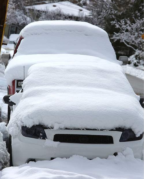
Heavy snow in northern Nevada and the Sierra has closed schools throughout the Reno-Sparks area and triggered an avalanche that shut down a California highway just west of Lake Tahoe.
The Washoe County School District cancelled all classes Monday after more than a half-foot of snow fell overnight on some parts of Reno.
Carson City schools were on a 2-hour delay, the same with Western Nevada College. Douglas County Schools were canceled Monday. Lyon County schools operated on a 1-hour delay.
U.S. Interstate 80 reopened over the Donner Pass west of Truckee, California, but chains or snow tires were required and a number of other Sierra passes remain closed.
Two cars were trapped but no one injured when an avalanche closed California State Highway 89 between the Squaw Valley ski resort and Tahoe City, California.
KRNV-TV in Reno reports the avalanche dumped snow 12-feet high across about a 200-foot stretch of the highway shortly after 1 a.m. Monday.
Heavy snow at Lake Tahoe has caused a roof to collapse at a liquor store and forced the evacuation of neighboring businesses, including a South Lake Tahoe pet hospital.
South Lake Tahoe Fire Chief Jeff Meston says the roof collapsed and broke a sprinkler pipe at a liquor store on Harrison Avenue at about 2:45 a.m. Monday.
No one was hurt. But Meston told the Lake Tahoe News there was a “ton of water on the street” when crews arrived. He says local utility workers had to dig through more than a foot of snow to find the main shut-off valve.
Animals at the nearby Sierra Veterinary Hospital have been evacuated while officials inspect the integrity of the neighboring businesses.
The National Weather Service reports that 30 inches of snow fell at the Heavenly ski resort at South Tahoe between 6 a.m. Sunday and 6 a.m. Monday. A total of more than 7 feet has fallen there over the past five days.
Check NVRoads.com before traveling.
•••
The tail end of a punishing winter storm system lashed California with thunderstorms and severe winds Monday after breaking rainfall records, washing out roads and whipping up enormous waves. At least four people died and several others were rescued from raging floodwaters during three storms in four days.
A thunderstorm brought ashore hail northwest of Los Angeles in Santa Barbara County, where a tornado warning was briefly issued. No tornadoes were reported but wind gusts topped 60 mph.
Flood watches and warnings remained in place for much of Southern California, a day after nearly 4 inches of rain fell south of Los Angeles, inundating roadways, toppling trees and raising concerns about damaging mudslides.
Commuters faced a messy drive to work, with rainfall expected to ease slightly but not taper off until Tuesday. Motorists were urged to use caution on mountain passes where heavy snow fell.
The National Weather Service had warned that the system could be among the strongest storms in years, and it delivered.
Long Beach Airport received 3.87 inches of rain by 5 p.m. Sunday, breaking the all-time daily record for rainfall. Los Angeles Airport got 2.78 inches, another single-day record.
California has been swamped during a wet winter that has brought plenty of rain and snow after years of drought.
A man’s body was found in a rain-swollen creek in rural northern San Diego County, which received more than 2.5 inches of rain. The water was moving so swiftly that crews were not immediately able to pull the victim to shore, according to the Union-Tribune newspaper.
Along coastal San Diego, two women were swept into the ocean by a large wave Saturday in Sunset Cliffs. Both were pulled from the water after a treacherous rescue operation, but one of the women, a 23-year-old, later died at a hospital, San Diego Fire-Rescue Capt. Joe Amador said.
Rescuers were set Monday to resume a search for an 18-year-old woman whose car plunged into a rushing creek after a collision Sunday southeast of San Francisco. Alameda County Sheriff’s spokesman Sgt. Ray Kelly told KNTV recovery efforts were hampered by dangerous conditions.
Firefighters in San Bernardino County east of Los Angeles staged a dramatic swift-water rescue of a couple whose pickup truck was trapped in surging water west of the Cajon Pass.
Television footage showed rescue crews sending a raft, which was anchored to a firetruck, into rushing brown water so the trapped couple could climb aboard, one by one, from the car’s passenger window.
It was one of several similar rescues across the state, leading authorities to warn drivers to avoid roads with even minimal flooding.
Residents in rural Santa Cruz County south of San Francisco watched helplessly Sunday as the San Lorenzo River spilled over its banks for the second time this month, sending muddy water and debris into yards and homes. No injuries were reported.
Traffic was diverted off interstates 110 and 710 south of downtown Los Angeles because of water flowing across lanes.
Hundreds of homes remained evacuated near wildfire burn areas in Santa Barbara, Los Angeles and Orange counties. Potential debris flows could restrict access for emergency responders, officials said.
In northwestern Mendocino County, a massive oak toppled onto an apartment in the city of Ukiah early Saturday, crushing the building and killing a woman as she lay in her bed, fire officials told the Press Democrat newspaper of Santa Rosa. The woman’s boyfriend and a 3-year-old boy escaped.
The San Francisco Bay Area was under a high surf advisory along the coast until early Tuesday with waves of up to 19 feet expected, National Weather Service meteorologist Steve Anderson said.
A historic WWI-era ship called the S.S. Palo Alto and docked near Santa Cruz was torn apart by massive waves Saturday.
The Bay Area was also under a flash flood watch that continues through Monday.
•••
After weeks of nothing but snow and rain, the region may finally be looking forward to a break, said the National Weather Service in Reno.
Although the storm system is exiting the region, there’s still a chance for light snowfall Wednesday morning and snow showers on Thursday, reaching up to at least an inch. The NWS said the possible upcoming snowstorm will not be expansive but reccomends the public to stay updated with local weather forecasts throughout the week.
“It’s been an incredible January, weather-wise,” said Scott McGuire, observing program leader of NWS. “We should have a good week because of the nice break.”
After this week, the region may be finished with massive storms for the month, at least until the beginning of February, he said.
Temperatures during the day will be in the mid-30’s for the rest of the week, with lows in the mid-20’s. McGuire said the lows will decrease at nighttime.
In the last day, the Sierra received 2-3 feet of additional snowfall and over 100 inches at ski resorts.

Comments
Use the comment form below to begin a discussion about this content.
Sign in to comment