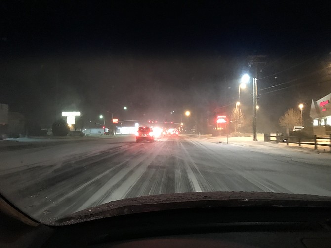
 However, the wind may be blowing snow. It isn't as bad as this from earlier on Thursday:
••• Due to the inclement weather anticipated by the National Weather Service, and in the interest of their safety, our delivery team may experience travel challenges and delays. To stay on top of breaking news, and to get the information you have come to trust from the Nevada Appeal, visit our website, download our app, follow us on social media and view our e-edition online. We’ll keep you up to date as the scenario unfolds. Plan ahead and leave yourself plenty of time, if you have to travel. Be sure to allow extra time to reach your destination.At some points during the day, it’s been snowing 4” an hour! ?: Asa Moore, Groomer at Squaw #mysquawalpine pic.twitter.com/3zKKp64PiF
- Squaw Alpine (@squawalpine) March 1, 2018
 •••
As the wind picks up nearing the 9 p.m. hour in Carson City, the National Weather Service predicts blizzard like conditions soon and into the overnight hours. Snow accumulations of 2 to 5 inches are possible tonight. Above 5,000 feet 5 to 8 inches of snow is expected.
•••
In the last hour in Carson City, we have seen rain then snow then rain then snow and now back to a mix.
•••
As the wind picks up nearing the 9 p.m. hour in Carson City, the National Weather Service predicts blizzard like conditions soon and into the overnight hours. Snow accumulations of 2 to 5 inches are possible tonight. Above 5,000 feet 5 to 8 inches of snow is expected.
•••
In the last hour in Carson City, we have seen rain then snow then rain then snow and now back to a mix.
 In just a short span it is going from snow to rain. Be careful driving. Use caution and take extra time.

 The Winter Weather Advisory remains in effect from 4 p.m. this afternoon until 10 a.m. Friday. Snow accumlations of 2-to 6-inches with 6-12 inches expected above 5,000 feet.
Additional snow accumulations are possible Friday night. The heaviest snow is expected this afternoon and late this evening through early Friday, according to the National Weather Service.
The NWS says travel conditions, including the evening commute today and Friday morning commute could be impacted.
A winter storm warning began at 10 p.m. Wednesday and extends through 10 a.m. Saturday.
Storm watches and winter advisories also will be in effect for most of Northern Nevada, from Reno to the Utah state line during much of that time period as the biggest storm of the season makes its way across the region.
Avalanche danger will rise into the high category in the mountains around Lake Tahoe, where winds could gust up to 125 mph on the ridges and 40 to 60 mph in wind-prone valleys, the weather service said Wednesday.
"Strong winds will combine with very heavy snowfall rates to create dangerous, potentially life-threatening … whiteout conditions," the weather service in Reno said in a statement.
Travel will be difficult Thursday and Friday with damage to some trees and power lines likely, the service said.
"Even a short walk could be deadly if you become disoriented," the weather service said.
Anywhere from 2 to 5 feet of snow is expected in the upper elevations around Tahoe, with 1 to 3 feet at lake level.
A winter weather advisory runs from 4 p.m. today to 10 a.m. Saturday along the Sierra's eastern front, including Reno and Carson City where 2 to 5 inches is expected on the valley floors and up to 12 inches in the foothills
•••
Carson City roads and I-580 to Reno are clear as the storm appears stuck in the mountains.
The National Service is predicting dangerous blizzard conditions in the Lake Tahoe area today, with winds gusting over the ridge tops in excess of 100 mph. As much as 5 feet of new snow is expected to fall on upper elevations by the weekend.
A rare blizzard warning goes into effect at 8 a.m. today and runs through 4 a.m. Friday. A winter storm warning began at 10 p.m. Wednesday and extends through 10 a.m. Saturday.
Storm watches and winter advisories also will be in effect for most of Northern Nevada, from Reno to the Utah state line during much of that time period as the biggest storm of the season makes its way across the region.
Carson City's hourly forecast from The Weather Channel:
The Winter Weather Advisory remains in effect from 4 p.m. this afternoon until 10 a.m. Friday. Snow accumlations of 2-to 6-inches with 6-12 inches expected above 5,000 feet.
Additional snow accumulations are possible Friday night. The heaviest snow is expected this afternoon and late this evening through early Friday, according to the National Weather Service.
The NWS says travel conditions, including the evening commute today and Friday morning commute could be impacted.
A winter storm warning began at 10 p.m. Wednesday and extends through 10 a.m. Saturday.
Storm watches and winter advisories also will be in effect for most of Northern Nevada, from Reno to the Utah state line during much of that time period as the biggest storm of the season makes its way across the region.
Avalanche danger will rise into the high category in the mountains around Lake Tahoe, where winds could gust up to 125 mph on the ridges and 40 to 60 mph in wind-prone valleys, the weather service said Wednesday.
"Strong winds will combine with very heavy snowfall rates to create dangerous, potentially life-threatening … whiteout conditions," the weather service in Reno said in a statement.
Travel will be difficult Thursday and Friday with damage to some trees and power lines likely, the service said.
"Even a short walk could be deadly if you become disoriented," the weather service said.
Anywhere from 2 to 5 feet of snow is expected in the upper elevations around Tahoe, with 1 to 3 feet at lake level.
A winter weather advisory runs from 4 p.m. today to 10 a.m. Saturday along the Sierra's eastern front, including Reno and Carson City where 2 to 5 inches is expected on the valley floors and up to 12 inches in the foothills
•••
Carson City roads and I-580 to Reno are clear as the storm appears stuck in the mountains.
The National Service is predicting dangerous blizzard conditions in the Lake Tahoe area today, with winds gusting over the ridge tops in excess of 100 mph. As much as 5 feet of new snow is expected to fall on upper elevations by the weekend.
A rare blizzard warning goes into effect at 8 a.m. today and runs through 4 a.m. Friday. A winter storm warning began at 10 p.m. Wednesday and extends through 10 a.m. Saturday.
Storm watches and winter advisories also will be in effect for most of Northern Nevada, from Reno to the Utah state line during much of that time period as the biggest storm of the season makes its way across the region.
Carson City's hourly forecast from The Weather Channel:
 ••••
Snow is starting to stick to the Lake View Hill area of I-580 as of 8:30 a.m. I-580 through Washoe Valley is still clear but as commuters leave or arrive into Carson City, snow is starting to stick.
A view from the Nevada Department of Transportation's cameras.
••••
Snow is starting to stick to the Lake View Hill area of I-580 as of 8:30 a.m. I-580 through Washoe Valley is still clear but as commuters leave or arrive into Carson City, snow is starting to stick.
A view from the Nevada Department of Transportation's cameras.
 Current road conditions:
 A current screenshot of the Weather Channel's radar:
 •••
As of 7:30 this morning, Carson City roads were clear. The storm is starting to leave moisture in Washoe Valley and the Galena Creek Bridge area. I-580 is still flowing with no controls this morning. If you are headed to the lake, chain and snow tires are required.
•••
As of 7:30 this morning, Carson City roads were clear. The storm is starting to leave moisture in Washoe Valley and the Galena Creek Bridge area. I-580 is still flowing with no controls this morning. If you are headed to the lake, chain and snow tires are required.
 •••
As of 6:30 this morning, Carson City roads were clear but the storm was moving in from the west.
Here are current road conditions, be sure to check http://nvroads.com/ for more information.
•••
As of 6:30 this morning, Carson City roads were clear but the storm was moving in from the west.
Here are current road conditions, be sure to check http://nvroads.com/ for more information.
 There's an 85 percent chance of light snow in Carson City between now 7 a.m. At 7 a.m. the National Weather Service predicts rain and wind for the rest of the morning.
 Incline Village schools are canceled for today as the storm has dropped a significant amount of snow at the lake, as seen in this screen shot taken of the Nevada Department of Transportation's Mt. Rose Summit camera.
 The National Service is predicting dangerous blizzard conditions in the Lake Tahoe area today, with winds gusting over the ridge tops in excess of 100 mph. As much as 5 feet of new snow is expected to fall on upper elevations by the weekend.
A rare blizzard warning goes into effect at 8 a.m. today and runs through 4 a.m. Friday. A winter storm warning began at 10 p.m. Wednesday and extends through 10 a.m. Saturday.
Storm watches and winter advisories also will be in effect for most of Northern Nevada, from Reno to the Utah state line during much of that time period as the biggest storm of the season makes its way across the region.
Avalanche danger will rise into the high category in the mountains around Lake Tahoe, where winds could gust up to 125 mph on the ridges and 40 to 60 mph in wind-prone valleys, the weather service said Wednesday.
"Strong winds will combine with very heavy snowfall rates to create dangerous, potentially life-threatening … whiteout conditions," the weather service in Reno said in a statement.
Travel will be difficult Thursday and Friday with damage to some trees and power lines likely, the service said.
"Even a short walk could be deadly if you become disoriented," the weather service said.
Anywhere from 2 to 5 feet of snow is expected in the upper elevations around Tahoe, with 1 to 3 feet at lake level.
A winter weather advisory runs from 4 p.m. today to 10 a.m. Saturday along the Sierra's eastern front, including Reno and Carson City where 2 to 5 inches is expected on the valley floors and up to 12 inches in the foothills
The National Service is predicting dangerous blizzard conditions in the Lake Tahoe area today, with winds gusting over the ridge tops in excess of 100 mph. As much as 5 feet of new snow is expected to fall on upper elevations by the weekend.
A rare blizzard warning goes into effect at 8 a.m. today and runs through 4 a.m. Friday. A winter storm warning began at 10 p.m. Wednesday and extends through 10 a.m. Saturday.
Storm watches and winter advisories also will be in effect for most of Northern Nevada, from Reno to the Utah state line during much of that time period as the biggest storm of the season makes its way across the region.
Avalanche danger will rise into the high category in the mountains around Lake Tahoe, where winds could gust up to 125 mph on the ridges and 40 to 60 mph in wind-prone valleys, the weather service said Wednesday.
"Strong winds will combine with very heavy snowfall rates to create dangerous, potentially life-threatening … whiteout conditions," the weather service in Reno said in a statement.
Travel will be difficult Thursday and Friday with damage to some trees and power lines likely, the service said.
"Even a short walk could be deadly if you become disoriented," the weather service said.
Anywhere from 2 to 5 feet of snow is expected in the upper elevations around Tahoe, with 1 to 3 feet at lake level.
A winter weather advisory runs from 4 p.m. today to 10 a.m. Saturday along the Sierra's eastern front, including Reno and Carson City where 2 to 5 inches is expected on the valley floors and up to 12 inches in the foothills
Comments
Use the comment form below to begin a discussion about this content.
Sign in to comment