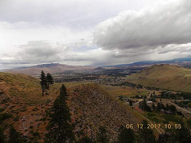
Carson City is seen from above the waterfall in Ash Canyon. Photo by Tom Schwartz.
Ash Canyon doesn’t get as much attention as King’s Canyon in Carson City, but it’s still a perfect opportunity for a short hike. It’s not strenuous and can be done anytime of the day, but it’s probably the most enjoyable to do in the morning or late evening during the cooler parts of the day.
This trail is a popular mountain bike trail, and now that the Epic Rides event is over, it might have less traffic than earlier in the season.
Ash Canyon is located on the west side of Carson City. When you get to Ash Canyon Road, you follow it to where the pavement ends and it turns into a dirt road. From there, most vehicles should be able to make it the last quarter of a mile and park at the water tanks. There are some separate trails veering off from the beginning, but it shouldn’t be hard to figure out the main one for Ash Canyon since there is a sign nearby describing the area.
The total distance of the trail is 2.2 miles, and it gains 488 feet of elevation. It’s a loop trail, so it follows an old road, then goes into the canyon near the creek and leads back to where you started. So you’re not going in and out on the same trail.
A few weeks ago, the creek was running high, and as you walked alongside it you could hear it trickling along. Since there are many plants growing alongside the creek, it’s very secluded by itself, but there are a few spots to get closer to the water.
The loop can be done from either direction, but staying on the road first is usually the preferred way to go. It’s a steady gain of elevation; it will take your breath away if you get going at a fast pace. There isn’t much for shade along this part of the route, but every now and then you get a decent spot to stop and drink water.
There is a view of the mountains in the distance as you hike westward into the canyon and can see the road continue.
There is a marker at what would be about the halfway point. From here, you go down into the canyon closer to the stream. The marker also shows the beginning of Ash to Kings trail, which connects Ash Canyon to Kings Canyon for a much longer hike. The road also continues deeper into the mountains, and apparently leads to Hobart Creek Reservoir.
There’s a picnic table right where the trail cuts in near the creek. It looks like the perfect spot to have a picnic and relax for a minute to enjoy some time in nature. You hiked this far to get away from the city, so you might as well enjoy the sound of the trickling of the creek and birds chirping.
The stroll back is nice and easy. It’s all slightly downhill. The trail follows the creek until there’s a short climb to get out of that part of the canyon back to the dirt road.
It’s a great hike to do after work during the weekdays, or a place to get some quick exercise. Just watch out for mountain bikers because it is a popular destination for them to ride.
Kyler Klix is a designer and contributor at the Nevada Appeal. If you’d like to talk about the outdoors or upcoming concerts, email him at kklix@swiftcom.com.

Comments
Use the comment form below to begin a discussion about this content.
Sign in to comment